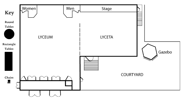
I drew this map layout for the Historical Lyceum of Galveston Island. The map is capable of being animated to show different layouts that event organizers can do. This interactive map was created using Adobe Animate which provides a comprehensive authoring environment for creating interactive and media-rich applications. Animate is widely used to create engaging projects integrating video, sound, graphics, and animation.